Loop #1, Counter-clockwise, August 15 – 19, 2021
Trailhead to Guskewau Lake (4 km – 2.5 hrs)
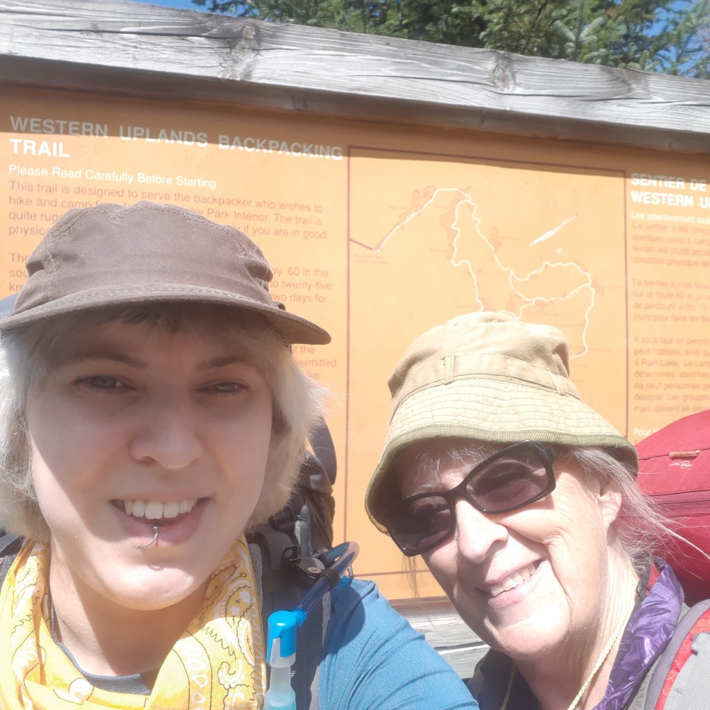
Got onto the Western Uplands Backpacking Trail with my mom on her 67th birthday at about 11:30 AM. After crossing the bridge at the Oxtongue River Picnic Ground (Kilometre 3 on Highway 60, just after the West Gate), and hiking in a short way, we went right at the first junction as a couple we saw in the parking lot went left. They had had a false start when she had forgotten her book and had to return to the car for it. We all chatted for a minute and I noticed she has the same Deuter backpack as I have.
The 4 km hike to Guskewau Lake was by far our easiest day, which I had planned that way since we had to do the drive there that morning. There was lots of mud, but I had been thoroughly warned about it from a variety of sources beforehand. This was only tricky to navigate in a couple of places during this first leg.

We camped at the second site off of the Guskewau Lake side trail, which is actually labelled site #3, since most people do the trail clockwise.

I hauled my watercolour kit all the way around Loop #1 for five days, but only had time and energy to paint at our Guskewau site on the very first night.
Our site, as well as the neighbouring site, had enough room to comfortably host multiple tents. It also included nice benches around the fire pit, about nine different grills (mom counted), and like all of our sites, it got the evening light.

It was such a short hike in that we didn’t feel the need to go for a dip in the lake, which is good, because from what I’d read this lake has leeches. We didn’t see any when we collected water though, and we noted that it had a nice flat bottom in the shallows. The neighbouring site, which is the first one you come across on the side trail when going counter-clockwise, had no water access.
The thunderbox was pretty far back from the site, and I had to keep going past three of the little signs to find it. All Algonquin sites have a thunderbox, so don’t give up looking!
For dinner, we had the basmati rice I had previously cooked and dehydrated myself, along with a single serving package (56g) of Nomad Nutrition’s Caribbean Curry. This was super tasty, but I think it really needed the rice to go with it, partially for added texture, but especially since we were splitting the smaller size and needed to stretch it out.
Overnight the temperature dropped to around 10oC and neither of us slept well. Mom in particular hates the cold, and even I had to put on my new Patagonia Pack In jacket to stay warm. We got a little sleep once the sun was up, and got a late start to our longest day on the trail.
Guskewau Lake to Norah Lake (10 km – 7 hrs plus a 1 hr break)
Aside from the late start, the trek to Norah Lake seemed to be going pretty well… at first. We left camp at 10:30 AM and arrived at Ramona Lake for our planned lunch break just before 1 PM. This was a little less than half way, and I was happy to find that we didn’t have to go down the side trail to the campsites to find a nice place by the lake to eat. We got lucky and just as we arrived at the junction with the side trail we crossed paths with a man who was going clockwise down the main trail so we asked if there was a spot to lunch, and he told us there was a perfect place just ahead.
We ate our fanciest trail meal, since this would be our hardest day, as well as the only day that our cold food would stay fresh. I busted out the cheddar cheese, salami, rice crackers, and a single orange that I quartered with my preferred knife, the Morakniv Eldris.

After eating, we took off our boots and put our feet up. This is my mom’s favourite foot care tip, and it really does seem to make a big difference. We spent an hour by Ramona, between eating lunch and resting our feet.

Then we carried on towards Norah. Somewhere along the way, we met a couple of men who told us that multiple moose had trampled through one of the Oak Lake campsites the night before, and to be on guard when camping in that area. I have been dying to see a moose over all my Algonquin trips, and still haven’t come across one, but that seemed like a bit too close of an encounter even for me.
After awhile we began to understand why the reservation system advises that only experienced hikers should attempt to go between Guskewau and Norah in a single day. It’s a long, hard walk. When planning the trip, I had seen a note on a map I found online that said that much of this section was old logging road, which reassured me that we could do it, but if this is true, it is only true for little bits here and there, and certainly not throughout.
We were pretty tapped by the time we got to Eu Lake. We sat on a log at the junction with the side trail, and ran into the couple who had started clockwise at the same time that we started counter-clockwise the day before. They were camping at Eu, and by then we had heard that it has a lovely campsite. We desperately wished we had booked that one instead of Norah which was still almost 4 km further. It was nice to run into them again. If we had been just a few minutes later, we would have missed them.
Once we got to the Oak Lake side trail, mom insisted we go in to the campsite to have a rest. I hated the idea of duplicating steps, but was just as exhausted, so we went in and laid down for a bit.

At some point near Norah, and actually in a couple places that day, we had a bit of trouble seeing where the trail continued on. The most notable of these was at a little rocky creek. The path seemed to disappear, but mom mustered the energy to scout ahead a bit and followed the creek a ways, then crossed it and veered right. She didn’t see a blue trail marker, but after awhile she was sure it was the trail, so she headed back and called out for me. I followed her, and eventually we noticed a trail marker pointing in the opposite direction. This trail was definitely designed with clockwise travel in mind, as we could see from the Lake signs which all faced away from us when we came upon them. – So when in doubt, it’s always a good idea to scout a little, and then turn around and see if there’s a marker that was hiding behind you.
At long last, we came to the Norah side trail. All of our water (about 2L each) was gone before we even got to that point. We were so relieved to see the sign, but knew from the map that there was still a little bit of a hike to get in to the site. We had no idea how treacherous this hike would be. We were incredibly tired by then, and most of the side trail was headed up, including the last bit, which was so straight up, and had such a sheer drop on our left side that we were not sure whether we’d be able to get back down again. My partner texted the weather forecast (I was able to receive texts on hills, but couldn’t access data almost anywhere on the trail or at campsites), and warned us that there might be rain in the morning around 8 or 9 AM. This was, by far, the most harrowing part of the journey. I was actually afraid that between the weather and our fitness level that we wouldn’t be able to get out on our own.
Cresting what may as well have been a mountain was a crushing disappointment. The Norah site was by far the worst site I’ve ever seen on an Algonquin backpacking trail. The only tent pad was wet, the fire pit had no benches, and the path down to the water was a long downhill that, by the time we’d arrived at the site, actually winded us to traverse. Once you were down by the water though, the lake was pleasant enough. It was a bit tricky to get into, and we gathered water with difficulty, but once we were in, we had a much-needed dip. There was a huge pile of scat along the way to the water, possibly belonging to a moose, though I’m no expert.
We also had a hard time finding a good bear hang tree, and lamented again the fact that Algonquin doesn’t have permanent ropes setup for this at every site.
I had chosen this site because it’s the only one on the lake, but the seclusion was not worth the effort at all. Mom always insists on finding the silver lining in things, so she decided she liked the rocks that provided a couple of decent (but low to the ground) work surfaces. There was also a brand-new thunderbox that I assume was installed during a recent lockdown.
We were so late arriving at the site (6:30 PM), that I was still boiling water and getting organized after dark. The temperature had risen, and we were more comfortable that night in terms of warmth, but I didn’t sleep a wink. I spent the whole night hoping it wouldn’t rain the next day, and that we wouldn’t need to be rescued. A light rain fell during the night while I was laying awake, which made me even more concerned, but it stopped after a bit.
Despite a lack of sleep, we got out of bed around 6:30 AM, and started to tear down so we could beat any rain that might be headed our way. We were very lucky that the climb down was reasonably dry. If it hadn’t been, I think we would’ve been using our rope to lower our packs down.
Norah Lake to Maggie Lake East (6 km – 4.5 hrs)
We left Norah at 8:30 AM, and got down safely. The trail was muddy, as always, but there was only one really challenging spot where you had to balance along a log for a much greater distance than usual. Most of the muddy areas were easy to go through or around, but this one was very wet, and balancing was the only real option.

Several people we passed going in the other direction told us that they had left Maggie just an hour before, but sometimes there was a full hour of hiking for us between these conversations. We quickly learned to double or even triple other people’s estimates.
At one point that day, mom slipped down a rock and fell, but she was fine, and even asked me to take a picture of her down on the ground. That same day, on one of our million micro-breaks, I sat on too low of a rock, and lurched forward when I was trying to get back up. My legs gave out under me, and I had to turn on to my side and use the rock to lift myself back up. I came out with a bruise on my arm, but was otherwise ok.

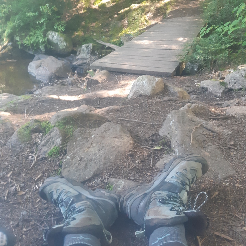
We were happy to get to the Mink Creek bridge, because it wasn’t much further to the Maggie East campsites. This bridge was somewhat grown over by long grasses, but in good shape and very easy to cross.
The hills near the end of this leg weren’t as bad as the day before, but we did find that the Maggie campsites were further apart than we expected from the map. We were told by another hiker that the first set of sites (#3-5) from our direction were lovely and even had beaches, but the one we could see from the trail was occupied, and we thought we’d be able to get to the others from the main trail, but I guess they are only accessible from that first side trail, which we didn’t venture down. We ended up at the site labelled #2 at about 1 PM. It was a lovely site with a great view of the lake, and very private.

The fire pit there was nice, with lots of benches and a couple standing grills, one of which I used as a table. The water access was off to the right when facing the site from the trail, and although it had a rocky bottom, it was easy enough to get to.
We were able to get settled before the rain came, and even had the tarp ready. It sprinkled off and on a few times throughout the afternoon, but barely touched us between the canopy and the tarp.

It was on this day that mom pointed out the absurd number of bug bites I had down the backs of my legs. This only got worse throughout the trip, and at one point I saw another woman whose legs looked about the same. I had wondered about why the majority of my bites weren’t itchy, and she said exactly the same thing. I honestly didn’t know they were even there until mom pointed them out on day three.
For dinner, we had my dehydrated chili and rice. I had almost no appetite, but was excited that it tasted so good. We had to pack up my leftovers, which mom ate the next day. She was ravenous the whole trip, which to some extent made up for my complete lack of interest in food.
That night, I remembered that I had packed night-time cold pills in the first aid kit, and decided to take one so I could finally get some real sleep. I think it was also that night that I had to treat my mom’s first blister. She did the Camino about a decade ago, and never got a single blister the whole 750 km she hiked because she covers her feet in Vaseline before putting her socks on, but this year her bunion got the best of her, and she needed a bit of protection for the rest of the trip. She also forgot to double up her socks before that, so that could’ve been part of the problem as well.
My feet fared well the entire trip thanks to my combination of wool liner socks with thicker wool socks over top, and my new Salomon Quest 4 boots. On all of our previous trips, mom and I had worn matching Under Armour Newell Ridge boots, but they had too small a toe box for me, which often resulted in blisters. This year I upgraded, and having the new boots plus my new trekking poles really made this trip possible for me to complete.
Maggie Lake East to Maple Leaf North (7 km – 4.25 hrs)
I was expecting this day of our journey to be longer and harder than it was. The stretch between the end of Steeprise and Little Hardy was particularly easy.
During a break by that second Steeprise sign, we ran into a young man who started to tell us about his hiking partner who was lagging behind him. Before he caught up, the first fella showed us a photo on his phone of the slower man’s shoe, which he had melted when trying to dry it by the fire the night before. A few minutes later the second man caught up and we saw the big hole in the top of his shoe in person, and we suggested he put some duct tape around it to hold it in place a little more comfortably.
They got ahead of us a bit, but by the time we caught up to them again at a lovely little rocky creek, they had taped him up, and were only worried about whether he’d be able to get it off and back on again without undoing their efforts. Moral of the story: don’t attempt to dry your shoes or boots by the fire when backpacking. (I strongly suggest wearing wool socks on wet trails, and even insisted my mother have a pair for this trip. Much better to have damp feet than melted footwear.)
We got to Maple Leaf North so early it was actually a bit of a surprise. At 2 PM we started to settle into site #7 after a very satisfying hike. This site is the uppermost one on the map, and although it is very close to site #6, it was not uncomfortably so. Although we really liked our Maggie Lake East site, the site at Maple Leaf Lake was probably the best one we had the whole journey. A good reward for our last full day on trail.

The access to the water didn’t look great at first, but once we were in, we had a good long sit on its sandy bottom and soaked up the sunshine.
It had an excellent level tent pad, and nice benches around the fire pit, including two flat ones, one of which we played cribbage on. Mom won two of our three games.
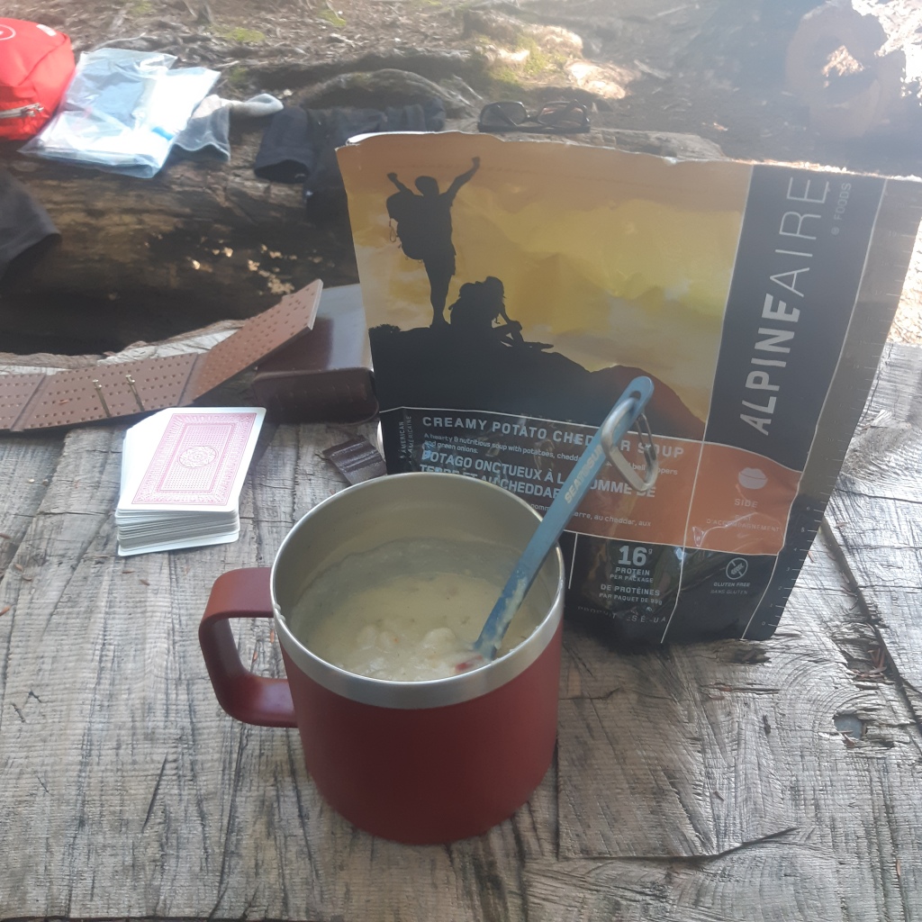
We had Alpine Aire’s Creamy Potato Cheddar Soup for dinner, which was exactly what I needed with my low appetite. Delicious! We also had the apple crisp of the same brand that I’ve been lugging around for years and never got around to eating, and it was ok, but I didn’t like it nearly as much as I liked the soup. Mom said it was a bit too sweet for her, and not quite enough cinnamon. I didn’t like that it had raisins.
I took another night-time cold pill and had a decent sleep on our last night.
Maple Leaf North to Trailhead (4.5 km – 3.25 hrs plus a 0.5 hr break)
We got a late start on our last day, but it didn’t matter. We headed out at 11 AM, and took the path to the east around Maple Leaf Lake, not completely sure whether there was a junction at the lower end of the lake, and not willing to backtrack. There did end up being a junction there, and I suspect the western trail is easier, as it is closer to the lake. The eastern path was very hilly.
We came to a lovely little waterfall just before the bridge, and mom stopped to dunk the handkerchief she was using to cool her neck, but dropped it in, then dropped a trekking pole in while trying to rescue the handkerchief. Fortunately, I was able to rush in and rescue both before the current took them.
The bridge that’s about halfway between Maple Leaf and the trailhead is a perfect place for a longer break. It has a great breeze off the water. We spent about a half hour there because I was finally able to connect to the internet, and we wanted to plan where we were going to eat upon getting off the trail.
There was one very steep and technical hill, that luckily was not very high, between the bridge and the last junction near the trailhead. After that there were a few more lesser hills, until finally we cheerfully arrived at that junction. The last leg, between the junction and the picnic ground, is a very short and easy stroll.
Boy, were we excited to see that bridge over Oxtongue and change into fresh clothes in mom’s van!
Quick Facts:
Signal Strength
Guskewau = no cell, no data
Norah = cell only, no data
Maggie East = cell only, no data
Maple Leaf North = cell only, no data
Bridge between Maple Leaf and Trailhead = cell and data
Food Consumption
Packed 10lbs of food (roughly following the 2lbs/person/day rule)
Ate around 3lbs of food, and packed out 1lb of trash (some of which we found at campsites)
Water Consumption
Consumed over 14L between the two of us over 5 days
I recommend carrying minimum 2L per person each day
Trekking Poles
Necessary
Starting Pack Weights
My Deuter Futura Vario 45 + 10 pack weighed in at 37lbs this trip, which was 1 or 2 higher than I’d hoped
Mom’s old Vaude pack started at 27lbs, which included the 10lb bag of food (and as we ate she took on a couple of small items from my pack)
