Bruce Trail: Beaver Valley

***It’s a new year, so I figured it’s about time I carry on with the last few Bruce Trail blog entries. Thanks for your patience and continued interest!***

Day #23: On the way to our parking spot for the day, we stopped and watched two foxes playing in the road, in the orange light of the early morning. I could’ve watched them forever, but eventually a car came over the hill and scared them off.

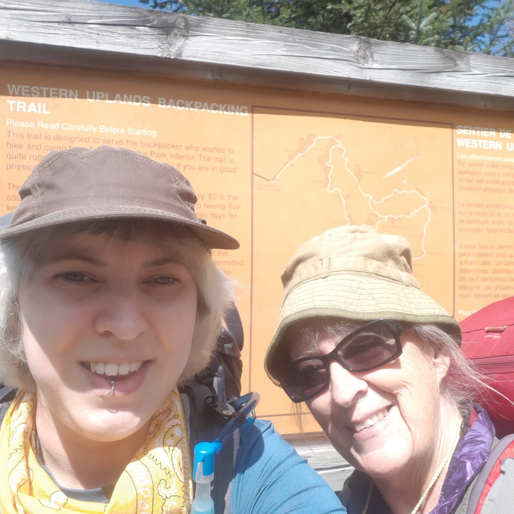
Trail angel Dan collected us at Duncan Crevice Caves, and returned us to 6th Line. Even though I had felt the night before like I needed another break, it turned out to be a nice day. – I actually wrote “nice day” in my journal entry, and in my trail conditions tracking notes, which is pretty rare looking back over the course of our entire journey. We had just under 20 km to hike that day – a short day –  so we let ourselves take some long breaks since there was no need to rush. We spent 8.5 hours on trail.

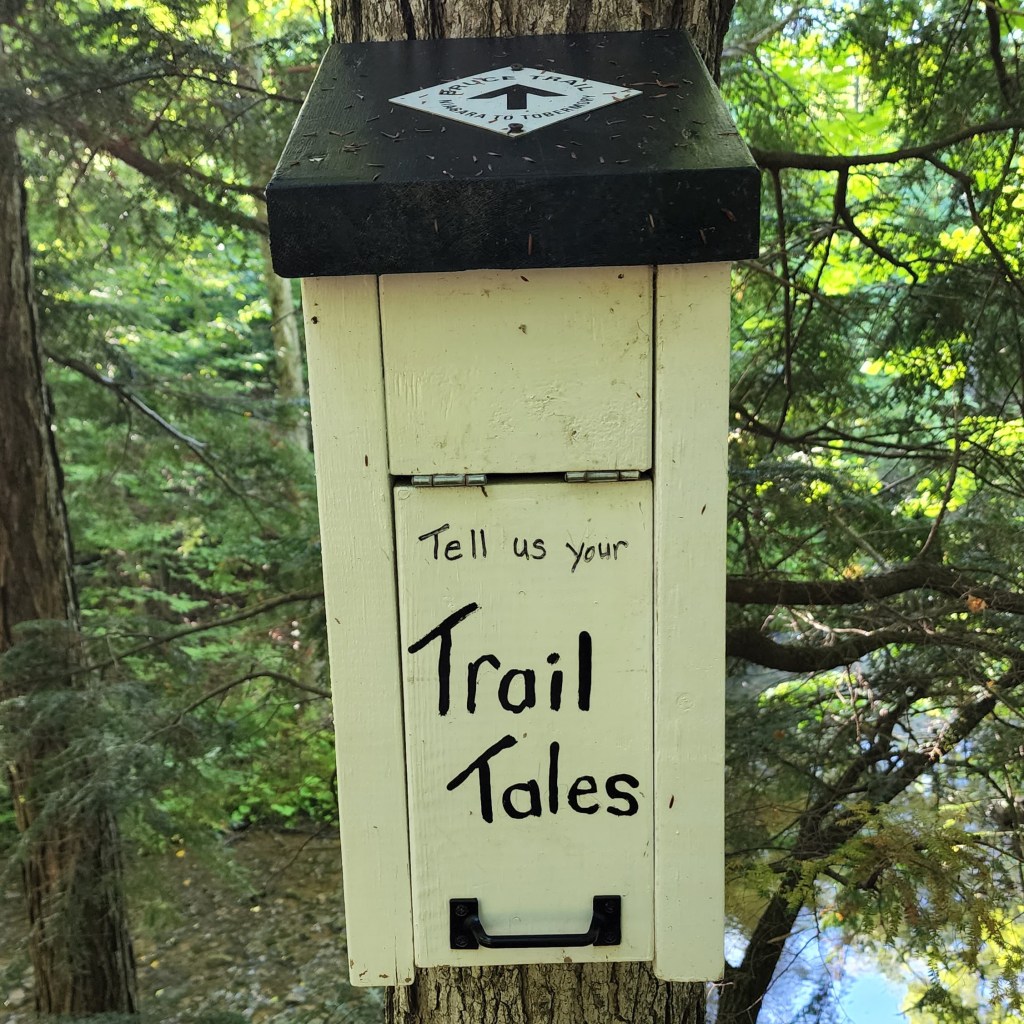
At 9 AM we stopped at a bench and wrote a bit about ourselves in the Trail Tales hiker log before carrying on again. About an hour and a half later, we came across the sign about Old Mail Road, which connected post offices in several hamlets from the 1830s to 1850s.

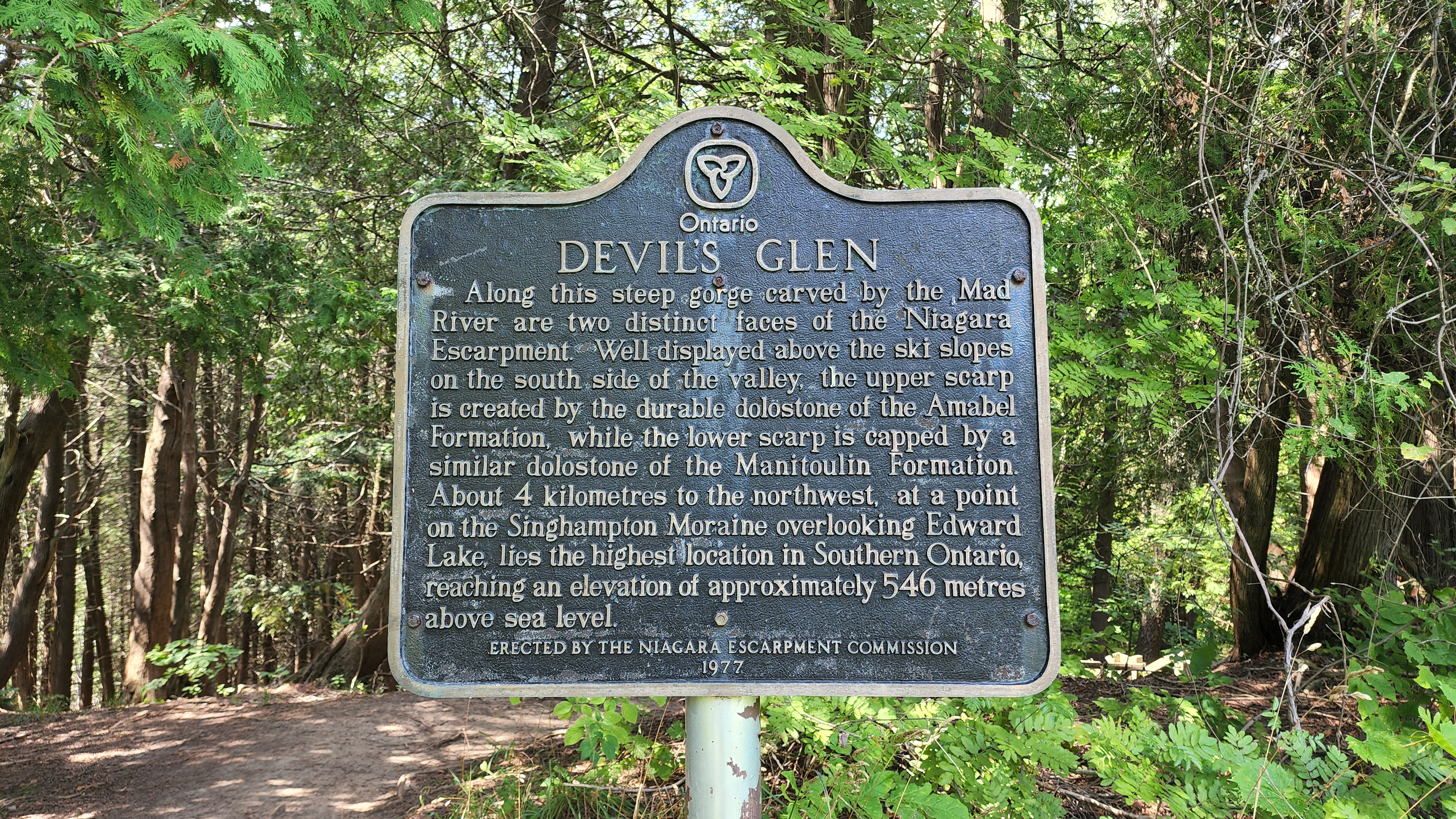
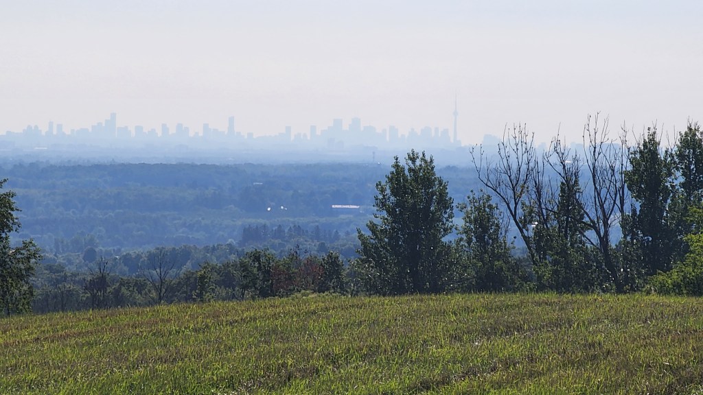
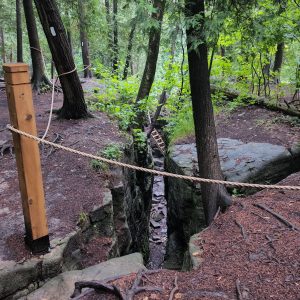
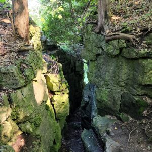
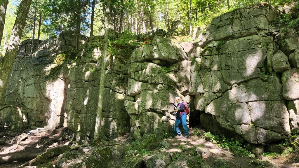
Before arriving at Metcalfe Rock, I remember speculating about why the rock would be named. Once we were there though, it was obvious. It’s a very impressive cliff face, both up close and from afar. Definitely the highlight of the day.

Finished hiking a little bit before 3:30 PM, and hung out for a while where we were parked before heading over to our trail hosts’ house. Lilla and John were remarkably generous with us. When we got there, John built us a campfire, and provided s’more fixings. (I thought it was quite smart that they use cookies with chocolate coating, rather than the usual separate graham cracker, with a huge chunk of chocolate that is too thick to melt properly. The thin layer of chocolate was perfectly melty after I applied my roasted marshmallow. Yum!) They let us use their machines to do laundry, and they even let me sleep in their spare bedroom, which allowed mom to have the van to herself for the night.

Day #24: In the morning, Lilla and John provided coffee! This place would’ve been a paradise, even without their breathtaking view of Beaver Valley. I sat outside with my coffee, and looked over the valley that we would be hiking all the way around over the coming days.

They drove us themselves from our parking spot at the Beaver Valley Lookout lot, back to Duncan Crevice Caves. Just before arriving at our trail head, we saw a family of turkeys on the road.

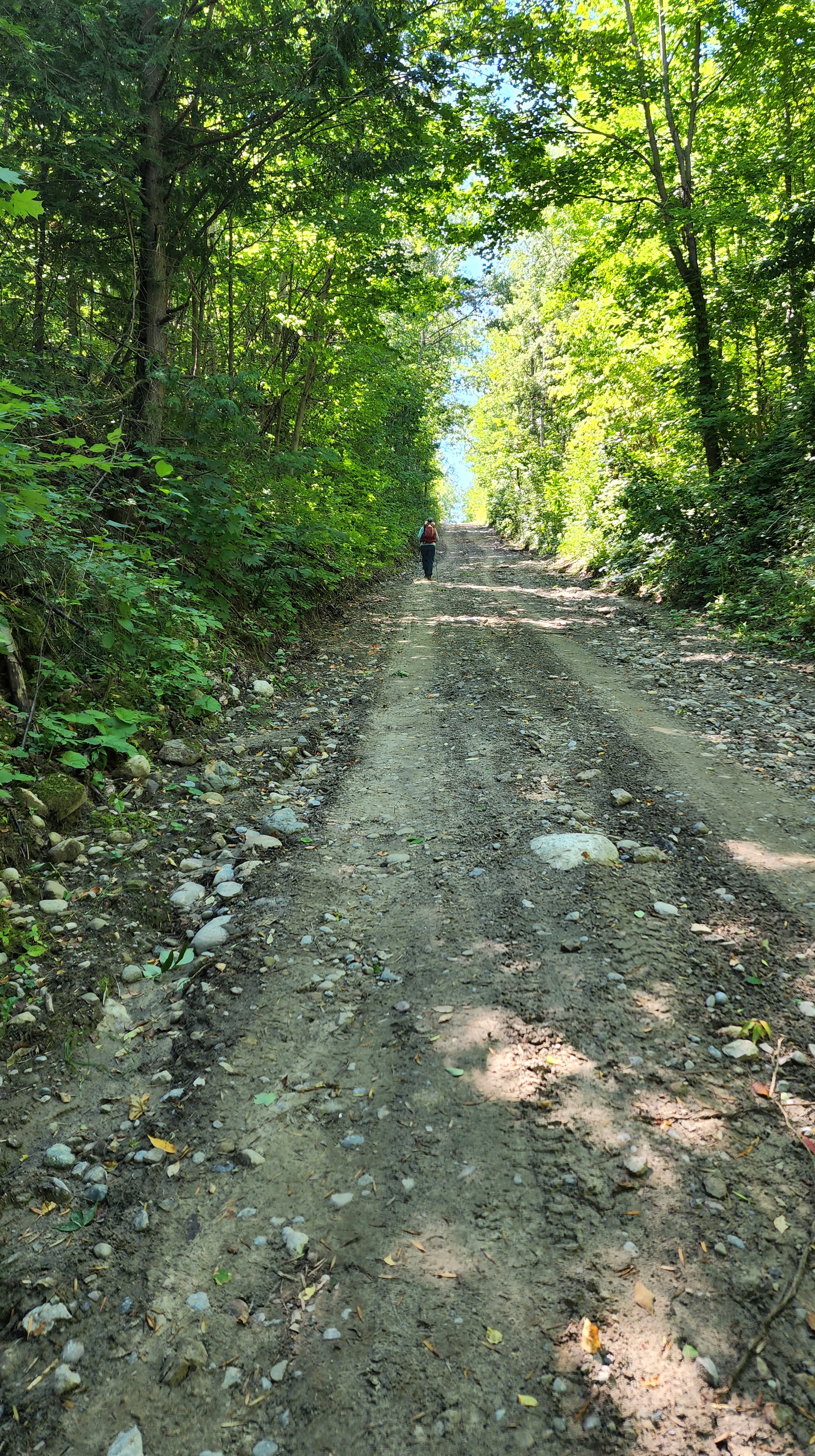
The 19.27 km day was relatively easy, with some rocky bits that were mostly decent footing regardless. Walking down Sideroad 7B was much less scary on foot than it had been when we drove down it in the van.

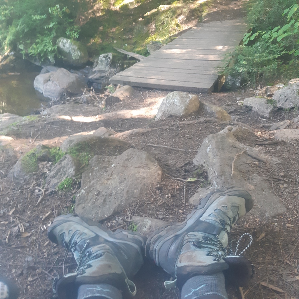
We took a long break at Kimberley General Store and shared a pint of chai ice cream. I took a photo of mom’s socks and boots, which she had laid out all over the sidewalk, and later wrote a short poem about it:

Climbing Old Baldy wasn’t too bad, but we were disappointed to discover the real pay-off view was down a side trail that we were not going to go down.

By the end of the day, we were still in decent shape, compared to other days. Mom went for the van, then picked me up at the roadside, and we both returned to the Beaver Valley Lookout lot to hang out in the sun. I thought about writing and my book for awhile, but didn’t get any actual writing done.

We bought a rotisserie chicken and made it into a salad, which we ate at in Markdale Foodland parking lot along with some potato wedges, then finally returned to Lilla and John’s for the night, and I slept in a real bed for a second night in a row.

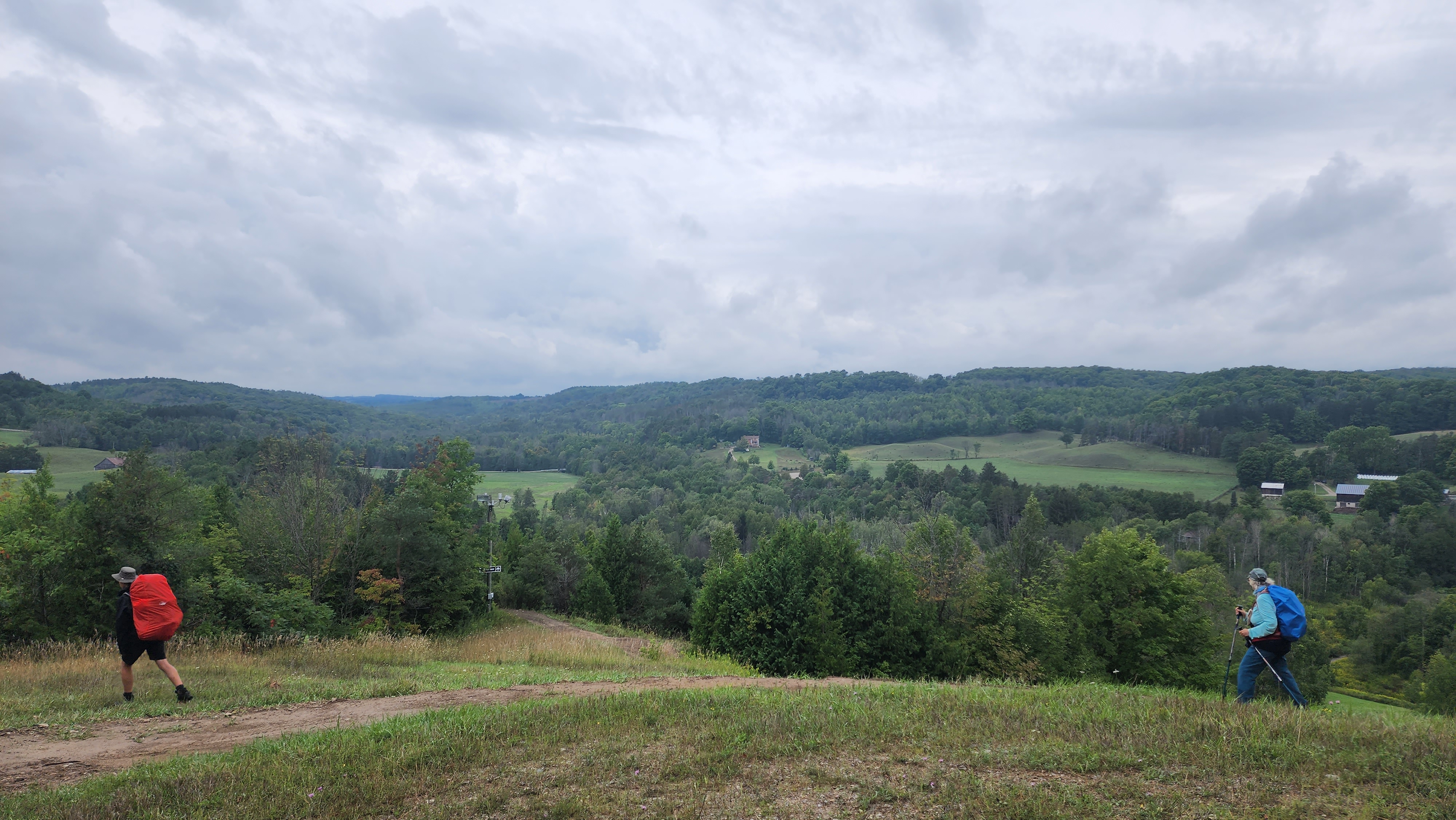
Day #25: Grabbed a coffee for the road before heading out to be shuttled by John. We parked at the Johnston’s Sideroad lot, and started back on the side of the road just south of the Beaver Valley Lookout lot.

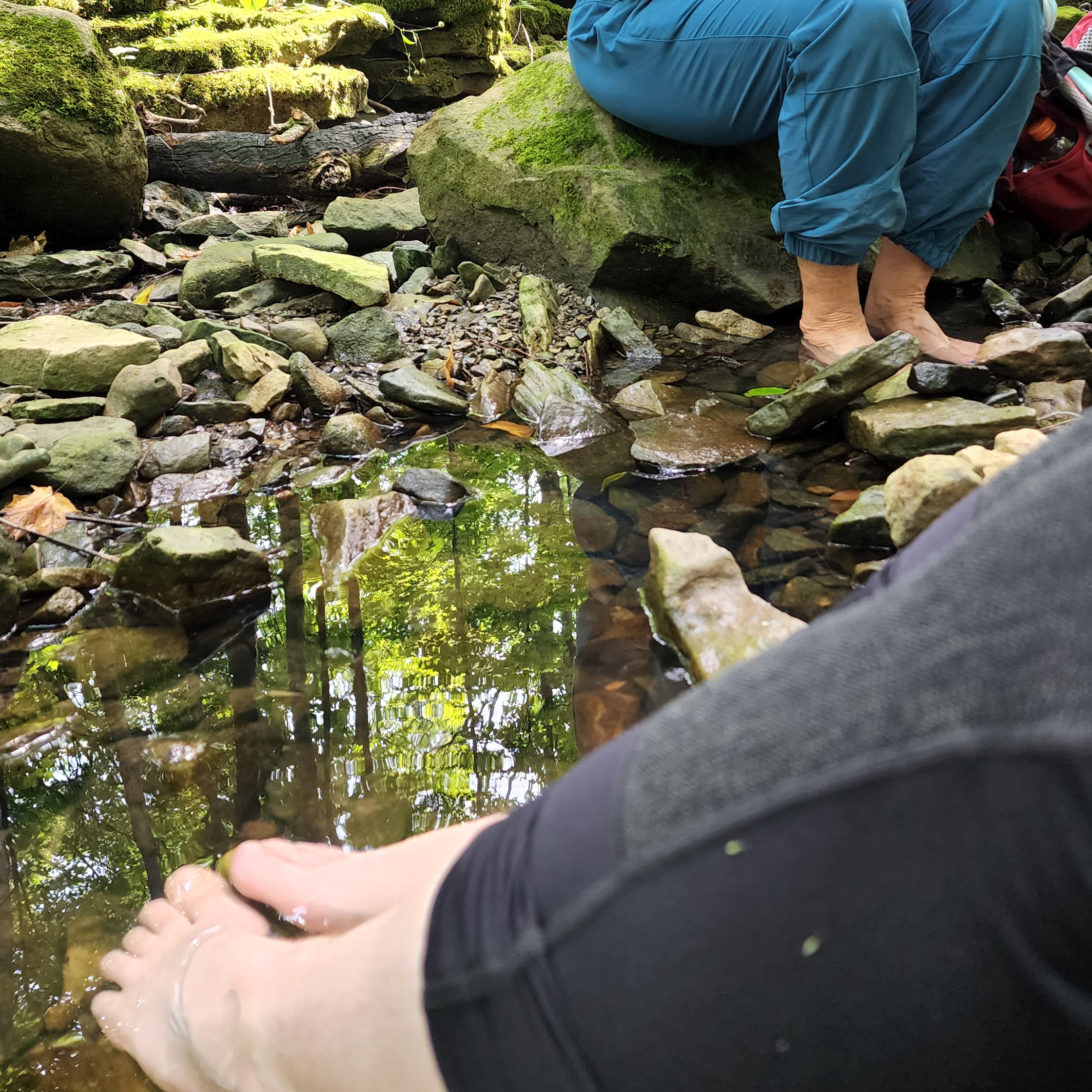
Just before 9 AM we found ourselves at the base of two towers. Around 11 AM, we put our feet in a lovely creek, where we were blessed by two young Catholic priests. Up until that point, the day had been manageable, but afterwards, we started to succumb to the relentless hills. Over the entire course of the day, we estimated that there was maybe a cumulative kilometre of flat terrain. There was no single notable hill, just endless ups and downs with no relief.

Eugenia Falls – up the creek from where we’d taken our long break – was pretty spectacular, and I stayed shortly to admire it, while mom meandered on ahead of me. We had many long conversations with other hikers, which slowed us down further, but broke up the day.

Eventually, we saw those towers again, but from the other side of the valley, right before we finished for the day. It was a hard 21.75 km, but the towers put it into perspective somewhat. We ate dinner in the parking lot, and I spoke to my partner on the phone.

Finally, we headed back to Lilla and John’s for my final night in that cozy bed.

Day #26: Had one last shower at Lilla and John’s, then followed them in the van to Sideroad 19, and they drove us back to Johnston’s Sideroad. Started the day in freshly mown dewy grass, which clung to my boots.

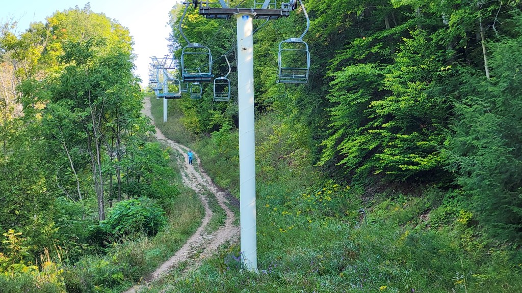
Mom seems to remember this day with horror. The dreaded day twenty-six, where things really changed for her. I think after feeling somewhat demoralized by those relentless hills the day before, she wasn’t in the best state to take on the actual ski hills. I, on the other hand, was finally getting stronger.

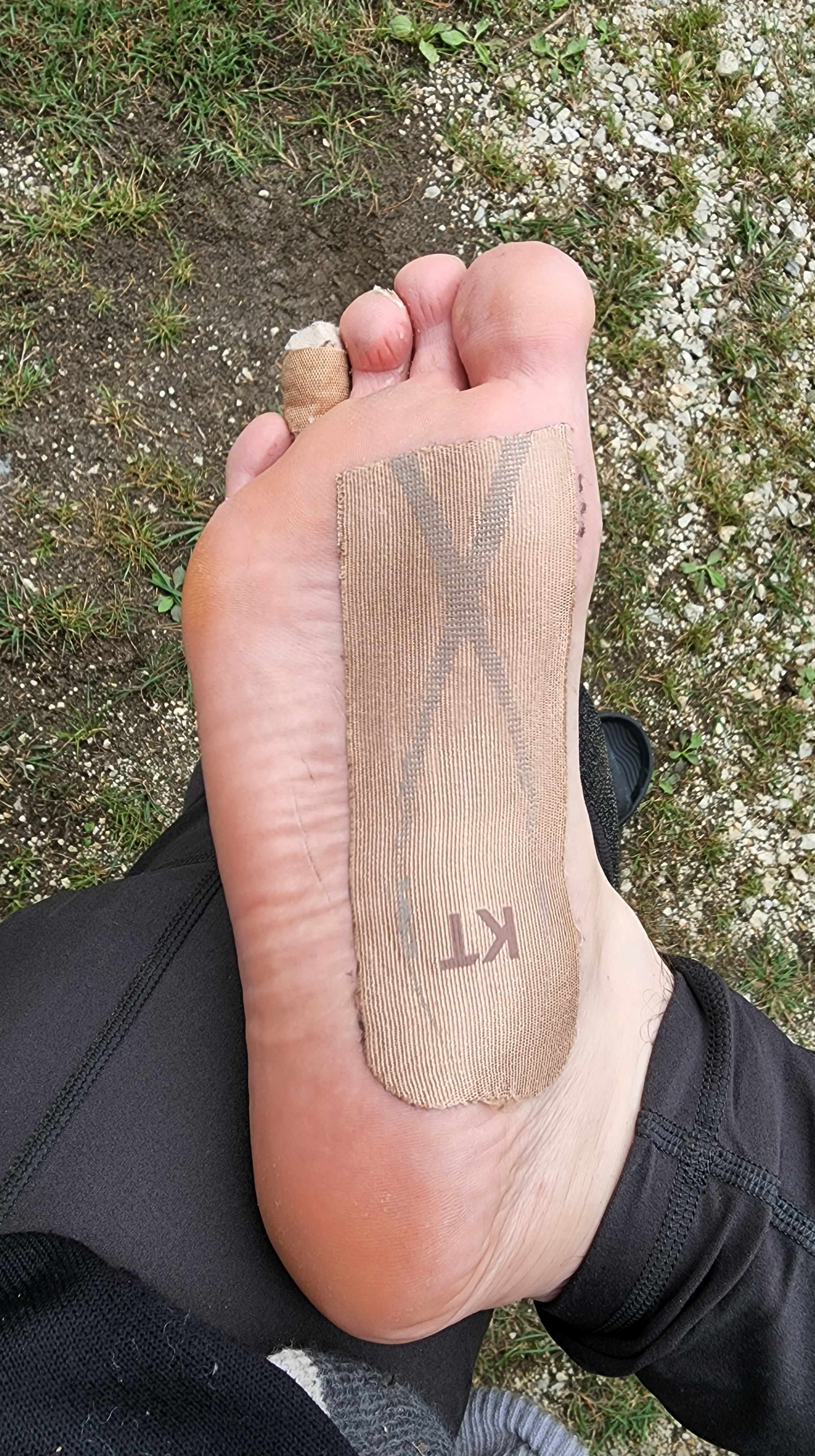
I took the lead and motored along until my feet hurt. – I developed a new blister on my pinky toe that day.

At one point we got slightly off trail, heading up a hill below some ski lifts. I went back down and found the blazes again, but mom was very reluctant to join me. Finally she descended, only to end up in exactly the spot where she would’ve been if I’d let her continue. There are no short cuts on the Bruce.

I was grateful we ended the 20.6 km day by walking along farmer’s fields instead of what looked like unimproved roads on the map. As always, it was nice to finally see the van on the horizon.

Day #27: We took our second, and what turned out to be our last zero day. I had coffee at the picnic table at the Beaver Valley Lookout lot. We moved there to let the van’s solar panels get some full sun while we relaxed. I pulled out my typewriter for the first time, and typed out some point form notes for my book.

A bunch of bikers came throughout the day, including a large group of veterans from Owen Sound. One woman from that group took interest in my typewriter, and we chatted for a bit. Her partner’s dog was riding in a sidecar, and that was the first and only time I’ve ever seen that in real life. Adorable!

Mom and I spent some time developing a new parking plan that lost us a zero, but would still get us to our camping reservations in the Peninsula on time without too many hard days.

I wrote my blog post about the Caledon Hills section, and it upset mom. Since then, I have struggled with writing about the trip at all. I’m trying to push through that now. The last thing I want to do is hurt her feelings, but I also want to be as honest as possible about my experience.

Day #28: Trail angel Kristina met us at Griersville and took us back to Sideroad 19. Over the morning, we only met one other hiker and his big dog Blue. We moved through the terrain with ease, and finished in record time. We spent less than six hours completing our 18.6 km day. It was smart to do a shorter day after our zero day.

We enjoyed Webwood Falls, and lots of pretty colours, especially a stretch of yellow fields with a red barn near the end of the hike. A nice woman who was part of a hiking group took a few photos of us before she carried on in the opposite direction.

Overall, this was the easiest hiking day to date. There were several benches, and very easy footing except some rock hopping in Griersville near the end.

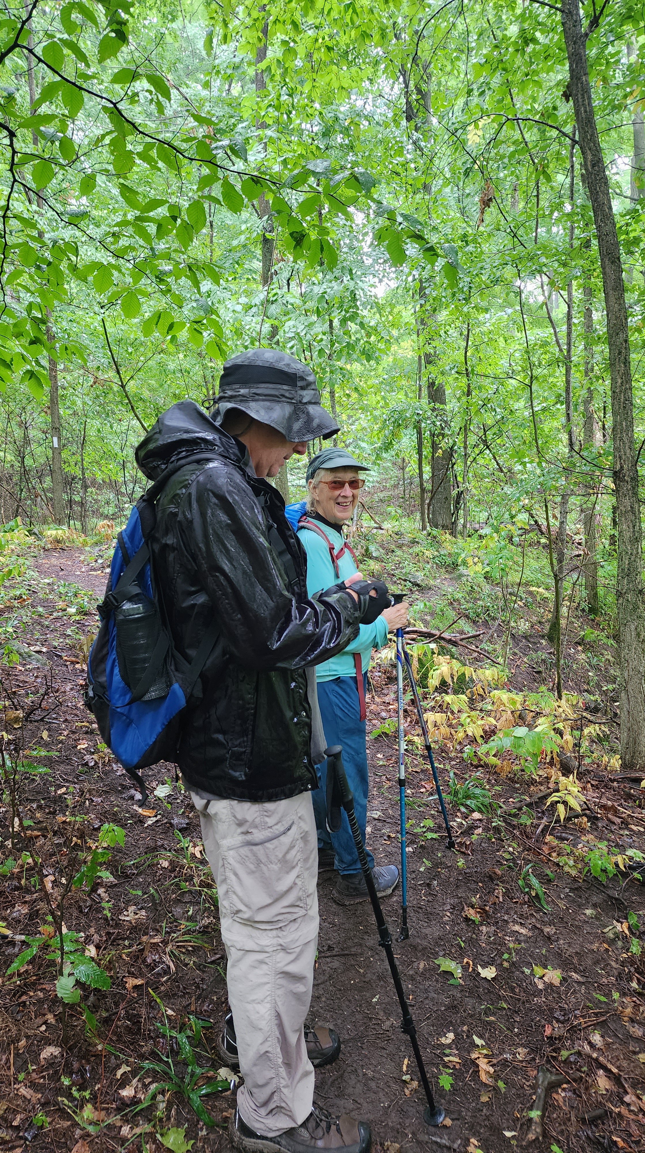
Day #29: Trail angel Rob returned to hike with us on this incredibly rainy, 22.7 km day! He picked us up at 4th Concession, and we all went hiking together starting at Griersville. We had a nice day chatting about writing, mom’s van-life, and whatever else, but boy did we get drenched.

We were okay through the early morning, but got absolutely poured on midday. I forgot to cinch up the cuffs of my raincoat, and so much water got in that my elbows were sitting in puddles as I walked along with my trekking poles.

There was one spot along the edge of the field that could really use a boardwalk. Once mom and Rob were across it, they stopped to watch my reaction to having to walk through the flooded area. Rob even snapped a picture of me mid-puddle, but I haven’t seen it. I imagine I don’t look too impressed.

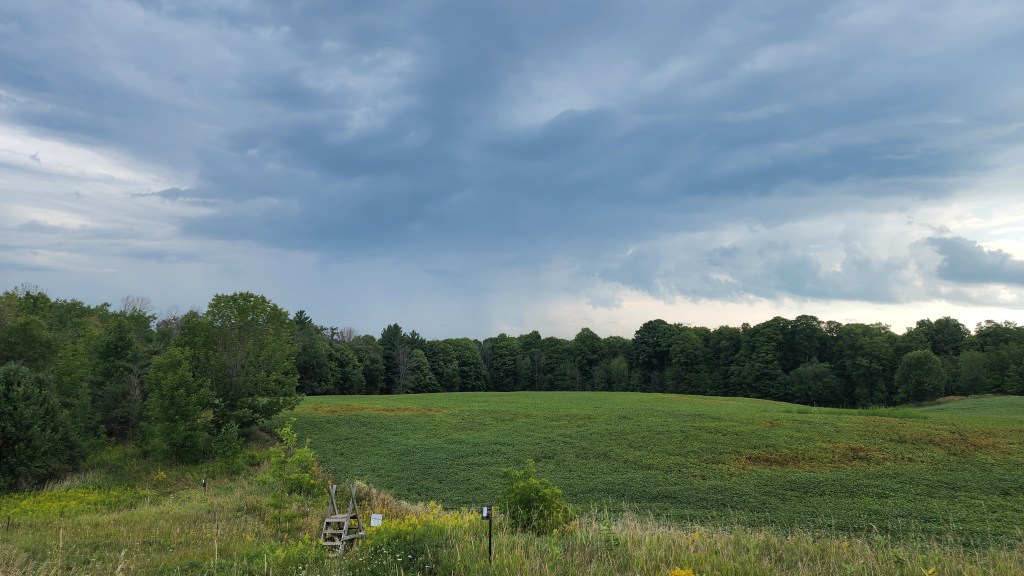
Fortunately, the rain let up for our lunch break, and then completely for our road-walking at the end. A huge storm loomed on the horizon though. At one point mom turned back to say something to me as we were nearing the van, and she audibly gasped at the sight of the gathering darkness. She said “nevermind”, and rushed her final steps back to the safety of the vehicle.

We popped Rob back to his car, exchanged some hugs, and said goodbye, both to Rob, and the Beaver Valley section.

Bruce Trail: Blue Mountains

***As of today, September 30th 2022, we are officially DONE our Bruce Trail end-to-end hike! Blogs about each section will continue to be written and released, as I play catch up.***

Day #20: Trail angel Rob met us at County Road 91 and returned us to 9/10 Sideroad for our 25.22 km hike. He jokingly referred to the Bruce Trail community as a cult. It isn’t, of course, but its members are very devoted to the trail, as well as the people who hike it, and we certainly would not be able to do this trip without their support.

Early on we found it unclear whether to walk on or beside Concession 10. The blazes were pretty far into the ditch, but we didn’t spot anywhere to enter, so we walked along the road. We got our pace up through a cedar forest in Nottawasaga Bluffs with mosquitoes pursuing us. One of our four breaks was at Mad River, then I got my pace up again rage-hiking after I got stung by two more wasps. I saw them both on my left calf as they stung me, swept them off, and told mom to run in case more were coming. That brings the count up to FIVE wasp stings on this trip. The injustice of it got me up and out of Devil’s Glen fast. Notably, there were a few places in Devil’s Glen where more blazes would’ve been helpful. Our last break we took on a stretch of grass after walking through a field for awhile. A woman came along on a bike and asked if we’d been on CBC. We were thrilled to be recognized!

We still felt OK by the end of our 9.5 hour hike and I suspect taping my arches helped.

Day #21: Rob and his wife Kelly collected us at Petun Conservation Area and delivered us to County Road 91. There were a lot more people out and about on trail, likely because it was a Sunday and we were in more popular areas. We chatted with some enthusiastic folks in Nottawasaga Lookout Provincial Nature Reserve, which was a beautiful and easy stretch of trail.

Pretty River Valley Provincial Park lived up to its name, but required a nearly 4 km trek across some serious elevation change that took us a full hour to climb. There were several view points at the top, and we took a break at the third one after talking to a family with several generations of hikers all out together who said we should hold out for that particular spot. Near the bottom of the hill, and then again at the top, we met a couple runners and they chatted with us for a while as well. Near the end, we met a volunteer maintaining the trail in preparation for the upcoming Blue Mountains end-to-end, and then finished the day at Petun Conservation Area after a short rocky bit. The 18.2 km hike took us 6.5 hours.

Day #22: Rob picked us up again at 6th Line and brought us to where the trail crosses the road after the Petun lot. I chugged down my coffee just as he was arriving to get us. Mom forgot to take off her white sweater before leaving with Rob, so I somewhat begrudgingly offered to carry it for the day in my big Deuter pack.

We did a bit of scrambling in the morning, just beyond Petun. I got my first ever view of Georgian Bay (or more specifically Nottawasaga Bay), followed by many subsequent views from the Blue Mountains. We spoke to a bunch of people at length again. A family that was billeting two young hockey players took our picture, and then a group of Asian hikers applauded us as we crested a steep hill. As I was stopped to bandage up my feet, we met two couples, the second of which included a young woman named Brie who said doing the Bruce was a dream of hers. She had done a lot of bikepacking with friends, but was hesitant to do any backpacking on her own, despite a desire to.

We crossed over to the Beaver Valley section, the boundary for which is oddly part way across the Blue Mountains. The Len Gertler Memorial Loree Forest was lovely, but some of the gravel stretches after were rough and steep. I limped to the finish line. My toes were hurting by then, as well as the rest of my feet, not to mention my knees and my back. It was another 25+ km day, and we got back to the van after just under 10 hours.

We struggled to find a trail angel for the next morning, and when we finally secured one, it was almost disappointing as I felt I could really use a break.

Bruce Trail: Dufferin Hi-Land

Day #17: Twila connected us with her friend Colleen, who we met up with on a dead end road where there was barely a shoulder (on 8 Sideroad at 2nd Line E). She took us back to Mono Centre to pick up where we had left off. We saw the windmills on the horizon along the drive, and again from the trail.

The day was easy throughout, with the exception of a couple big climbs. Without question, the highlight of the day was seeing dozens of monarch butterflies flitting about at the edge of a field that we passed through. I think it’s fair to say I saw more monarchs that day than I had seen cumulatively over the course of my life previously.

On a break shortly after, we got to dip our feet in an icy little stream that passed under a boardwalk, with a sprawling willow standing over it for shade. We moved pretty fast through easy terrain, even though my knees were slowing me down. Our hike started at 8:15 AM and we finished our 22.87 km day at 4:30 PM.

Day #18: After picking up a coffee, we went to Centre Road to meet trail angel Ian. He dropped us off at 8 Sideroad, and we started our hike. While we sat on a bench to have breakfast at a rural intersection, we met Iver, a runner, and his dog Cedar. Iver is running the Bruce in sections with a friend of his. While we were mid-conversation with him, a pair of hikers – Homer and Maria – came up to us and told us they are a brother-sister duo who are hiking the Bruce in sections. They were part way into a 32 km day that she joked would kill her, and he’d have to bury her in the cemetery in Lavender where they’d parked.

It was another relatively easy day, with a couple of big hills in the mix. Most memorably, there was an unimproved road (off of 20 Sideroad, I think) that was just more and more hill after every crest and turn. We also noted a short stretch of slightly more technical terrain between Prince of Wales and Centre Road. The day was 23.8 km, which we completed in just under 9 hours. We took long breaks at a rock formation, a stile, and a big old maple tree surrounded by cow patties on a lovely bit of farmland.

Later, we went to park at a trail angel’s house for the night, and learned that the farmland with the maple belongs to her brother, and that her and her son Henry the Hiker (@henry_thehiker) are developing a piece of land just off of the trail for hikers to camp on. I watched a murmuration of starlings flying around and above the cattle as the sun was going down before we filled our water jugs in the house, and finally went to sleep in the van.

Day #19: After meeting trail angel Jenn at 9/10 Sideroad, we started the day on Centre Road. We did not love the seemingly endless unimproved gravel road, but we did chat with a couple of people there. The first was a man with two dogs, who was very fond of the 40 kilometres of the Bruce that were ahead of us. The second was a woman named Wendy, and her dog Norse. She showed us the scars on her legs from the surgery she had after sustaining injuries on a trail in Sedona, Arizona. I worry a lot about getting injured on trail, especially with the type of loose rock underfoot that caused her fall, so the story has haunted me a bit since. We also met a farmer who mows the cemetery and who had met Leon, the German 18-year-old we had hiked with a few days before. The intersection after that cemetery in Lavender marks the boundary between Dufferin Hi-Land and Blue Mountains.

We passed the pond in Noisy River Provincial Park that Jenn had suggested we might take a dip in, but it didn’t look too inviting when we finally got down to it, so we opted for the creek instead which we came to shortly after. Just a few steps down from where the bridge crosses, we put our feet in for a soak. There was also a boardwalk with several short sets of stairs where we stopped because mom felt hot and exhausted. At that point, she felt she wasn’t sweating, which worried me.

Noisy River was pretty easy throughout, with the exception of some rocky bits, and the climb out of the valley. Afterwards, we came through several overgrown areas, which I was glad weren’t wet like that stretch of trail next to Highway 7.

At the end of the day, I spotted the van before mom did. She was walking ahead of me, and had continued to dutifully follow the white blazes in the wrong direction when we had to take a short jaunt down a side trail to get back to our parking spot. We drove the van to a nearby chip truck so I could get the poutine that I’d been craving for days, and also went to the convenience store next door to get a couple of ice cream treats. Then we spent the night across the road from Jenn’s, and used her exceptionally nice outhouse.

Bruce Trail: Caledon Hills

Day #14: We had a good sleep in the dark driveway of our trail angels, Twila and Gren. Mom and I went to the local Starbucks, used the bathroom, got some drinks, and hung out in the parking lot to do our CBC Fresh Air interview with Jason D’Souza. Mom sat on the patio, and I sat in the van while we were on air over our phones. It resulted in a late start hiking, but we both enjoyed the segment and discussed it throughout the day.

Later, when being shuttled by Twila and Gren, they told us that Elton John owns a property along our route for the day. When we got there, we enjoyed an incredible view of the Toronto skyline, and I ate my leftover Japanese food under one of his roadside trees. Since we had quite a bit of road-walking that day, I called up Justin and we had a chat on the phone while I walked with relative ease over the gravel. We text regularly, but it has been hard to find the time to actually talk. On Finnerty Side Road, we had our midday break under two big cedars with our Niagara ponchos spread out on the ground beneath us. Our final break was at Tim Horton’s, which the trail extends almost all the way to, forcing one to cross at the intersection, rather than where the trail would more naturally cross on busy Highway 9. Mom waited outside to keep an eye on our packs while the staff prepared our food. She was impatient to go to the bathroom, and was gesturing at me through the window while I waited for the food. It took a bit longer than expected. We got large lemonade slushies, and ate rice bowls outside sitting on the curb. She was frustrated with me for our failure to make a plan of where to sit before I went in to order, and most importantly, before she went to the bathroom. I hadn’t known the importance of any of that before she sent me in to get our food, so I shrugged it off and just tried to focus on enjoying the meal that I’d been fantasizing about for hours.

The terrain was quite easy compared to the early sections of the Bruce, but there were certainly hills. There was a particularly deep valley to climb out of just before we came to our parking spot. Once we got past the treeline, it was nice to see the van there from the top of the meadow after a 27.5km day. When we got back to Twila and Gren’s place, they let us use their shower (which was the most I’ve ever appreciated a shower), and gifted us peaches as well as what might be the best butter-tarts I’ve tried. It was well after dark by then, and they have a long, steep driveway, so Twila insisted on driving us back up to the top of their lane where we over-nighted in the van.

Day #15: I slept poorly, and struggled to keep my eyes open in the morning, even as mom was driving and I was navigating. The forecast had predicted bad weather, and I was rooting for there to be a storm so I wouldn’t have to hike. Mom got me out of bed with the possibility of a half day, though we parked as though we were doing a full day. I only lasted the two hours and 5.5km it took to get from 7th Line to Airport Road with me dragging my feet. I was inexplicably in tears most of the way. It was the first day where I just really did not want to be hiking. There had been a day (#7) where mom coaxed me into it and I came around, but that wasn’t going to work this time. I used the hail in the forecast as an excuse to message Twila, who sent Gren to rescue us at Airport Road. Really the weather was starting to clear after a little bit of rain, but I needed to get off the trail and it seemed like a reasonable excuse. Gren was very kind about it, and even pulled over when I had a moment of panic that I’d forgotten my trekking poles on the side of the road. Mom peered into the back of the truck, and they were there. He dropped us off at our van on Dunby road, where we had hoped to walk to, and I immediately had a much-needed nap. Afterwards, we went to Orangeville for the night, and the storm finally caught up with us. I went to sleep with the van shaking in the wind, and lightning on the horizon.

Day #16: We realized once Twila was on her way to us at Dunby Road that we were meant to walk beyond there to make up a little of the previous day’s lost time. She led us to Mono Centre where we parked for the day, and she returned us to Airport Road. Later her and Maggie (their dog) met us on a rugged side road to return my knife which had fallen off my pack belt in their truck. I worried Twila and Gren would think we were completely disorganized, but as always they were nothing but nice and accommodating.

Shortly after that, while taking a brief break, a German 18-year old named Leon caught up to us and spent the rest of the day hiking and breaking with us. He was a very nice young man who certainly could have said goodbye and outpaced us, but chose to keep us around for the company. He was also on his way to Tobermory, but had started near Georgetown. Something about having him with us sped us up considerably, and we set a record pace of 4.4 km/hr which we have yet to beat. We put in 23.5 km over 8.5 hours, with the breaks factored in. It was also a pleasure to offer up some trail magic of our own, as we loaded Leon’s pack with extra bars and other trail foods before he went on his way.

The day had many, many hills, but was easy footing, with the exception of a scramble off of 3rd Line. We noted that Caledon Hills had more stairs than previous sections, and that they had a very comfortable low rise. There were also plenty of creeks along the way. Day #16 marked the first third of the Bruce complete, and transitioned us into the next section.

Bruce Trail: Toronto Section

Day #11: Karen picked us up at Limehouse and took us back to the 401 underpass to start the Toronto section for our 20.4 km day. We had heard back from CBC via email that morning about doing a Fresh Air segment on our journey, so we called up Shana, a producer there, and chatted while we had an absolutely incredible view from the top of the escarpment. Afterwards, in Speyside, the mosquitoes were unrelenting until we got out onto a path between some farmer’s fields where we could see and hear the storm looming. We were headed towards it, and it was headed towards us. The long row of power lines towering above us for a stretch made me particularly nervous. We picked up the pace to cover the last bit of distance between us and the van, especially once the rain started to trickle down to us through the canopy. Mom laughed at me when I went to move from the cabin of the van to the front seat, and leapt in and slammed the door shut as lightning cracked above us. A literal minute after we were safely in the van, my phone received an emergency alert with a tornado warning for the area. It had been a hot day, and mom kept begging me to get out of the van and jump around in the rain, but I wouldn’t let her. The storm was too severe. It was quite some time before it passed enough for us to move on from the Limehouse lot. When we did get going, we had to stop and turn around because there was an emergency crew dealing with a very large downed tree which had fallen on some power lines and into the road. After arriving in Brampton, the storm caught up with us again and trapped us in the van for another little while before I was finally able to get out and get some food. With the raincoat partially covering my eyes and rain still coming down, I accidentally went into the wrong restaurant, and just got something there because I was too embarrassed to turn around and leave by the time I realized my mistake. I got to talk to Justin on the phone a bit that night to finally catch up. It was good to hear his voice. Mom bought some kind of non-alcoholic sparkling apple cider to celebrate over 200 kilometres of hiking together, and we also shared a pint of ice cream. I spent some time agonizing over the weather report, and hoping we wouldn’t be forced to take a zero day that would put us even further behind schedule.

Day #12: I woke up early to check the weather forecast again, and we decided to just go ahead and risk it. We met Karen at the roadside parking at Heritage Road and she took us back to Limehouse. It was full of incredible rock formations. The bugs were awful again, so we took all of our breaks on the sides of the roads we had to cross. Along Highway 7, the trail took us into some long grasses, wild flowers, and thistle that were absolutely saturated from the rain the night before. They bent over into the trail on either side to the point that it was hard to discern where it was, and it honestly felt more like bushwhacking. I got completely drenched, and my Goretex boots stayed wet into the next day. The mosquito situation didn’t improve much until we started escarpment-walking up in Silver Creek. Terra Cotta was our last conservation era of the day, but my feet hurt too much to appreciate it. I cried several times trying to get to the van in the last kilometres. Mom kept surging way ahead of me and refused to take a break. Her body seizes up sometimes when she stops, so she wanted to press on, but I desperately wanted to get off my feet and felt pretty frustrated with her unwillingness to balance our needs. After we finally finished up the nearly 25 km day, we spent the night at a motel in order to do our laundry, and take showers. I slept alone in a king-sized bed and was glad to have a bit of distance for the first time since starting.

Day #13: Marcus (@markonadventure), one of my longest standing Instagram friends since starting my @elisha.hikes account, offered to join us for a bit of our 21.5 km hike, and was also our trail angel that morning. He gave us a bag of peanut M&Ms, his favourite trail snack, and stayed with us until the stretch of road-walking after the Cheltenham Badlands, which we didn’t get to properly see. After he turned around to head back to his car, mom and I started paying attention for a good break spot. She was pulled off trail by the temptation of water, and got us off track enough that I had to do a difficult scramble one way, and then back again to return to the blazed path through the beautiful but technical rock formations. I finished the day tired and sore, but in better spirits than usual, and ordered myself some Japanese food at a little restaurant called Inaki, and ate in their parking lot. The server very kindly gave me some ice to go with my canned soda upon request. Then we went to park for the night in the driveway of our main Caledon Hills trail angels. I can’t say enough how amazing the trail angels have been. Our trip would not be possible without them. We have often lamented that there isn’t more infrastructure to support thru-hiking of the Bruce. There aren’t enough thru-hikers to merit catering to them, but without catering to them, it’s unlikely there will be many more. Other trails, like the Camino, or the triple crown trails in the States, better accommodate thru-hikers needs and therefore generate far more interest.

Bruce Trail: Iroquoia Section

Day #5: After finishing that last kilometre of the Niagara section in the morning, we ventured into Iroquoia. The day started strong. We crushed the first 11 km by 12:30PM. The terrain was much easier, even with the climb up Grimsby mountain early on. At some point we resorted to taking a break right in the way of the trail because we hadn’t found a good place to sit down in a long while. This forced four women to stop and talk to us as we scrambled to get our stuff out of their way. We had a long chat and learned that one of them is working on her own end-to-end, while some of the others had already completed theirs and were along to support the effort. Two offered to be trail angels should we need them further down the Bruce. The afternoon was easy enough as well, and took us to km 19.8 at Devil’s Punch Bowl where we had parked the van that morning. Mom left me on the side of the road to go collect the van from the parking lot, and discovered the reason for the sirens we’d heard a bit earlier. A man had intentionally driven through the barrier and died. An unfortunate end to the day. Naturally, we didn’t end up doing the side trail that leads there. Afterwards, we spent the evening with my Aunt Rosie, who has been a tremendous trail angel for us several times. We ate Chinese food in her yard in Brantford, did laundry in her machines, and I got to briefly see my two cousins for the first time in years, as well as meet their kids. Then we spent a hot night in the van on her street.

Day #6: Darryn was our trail angel the morning of our sixth day, and he drove us back to where we left off around the bend from Devil’s Punch Bowl. We saw two turkeys before we got back on trail. Early that morning, we came across three young people, in their late teens or early twenties, who had a campfire going under an overpass across the railroad tracks from us. Presumably they were still up from the night before. They yelled across to us, and were excited to learn we were headed all the way to Tobermory. One of them called out “If I get my backpack, can I come with you?” We took our long break at another overpass under Red Hill Valley Parkway, and were somewhat disappointed to discover that if we’d pressed on just a bit further, we could have put our feet in the water at Red Hill Creek after not having seen water in days. We didn’t get to soak our feet until we were back at the van and parked for the night. I just barely pushed through the day’s 27 km across Hamilton. We expected there to be stores or cafés to stop at, but the trail kept us away from the downtown. We did, however, have to go up some of Hamilton’s MASSIVE flights of stairs, which nearly killed me. I did note that the staircases had grooves on the sides for bikes to roll up and down, which I thought was a very clever bit of infrastructure in an escarpment city. Mom rushed me at the end, and was deeply concerned that the van might be towed if we didn’t get out past the gate before sunset (Dundas Valley Conservation Area parking at Artaban Rd). Sunset was a ways off still, which I tried to tell her, but she was past listening at that point. The heat had been hard on her that day.

Day #7: Mom and I disagreed about whether to hike on the seventh day of the Bruce. Between the potential for thunderstorms, and the state of my body, I was keen to take an early zero day, but she insisted. Sure enough, the storm didn’t come, and I was ultimately glad she had forced us to carry on. We did do a shorter day than I had planned, which was a relief. We tackled 22 km instead of the original 27 km. The morning started in the very peaceful Dundas Valley Conservation Area, where we scrambled up some rocks, saw two deer, and chatted with several hikers. A long reroute took us into residential Dundas, so I left mom at a bus stop bench with our packs, and was able to go a few steps off the trail to buy us some cold treats and a Powerade. I slowed our pace down to a crawl for most of the day because of the shape my body was in by then. Seven straight days of hiking is no easy feat. We did have a somewhat restorative break at the lovely Borer’s Falls, but my foot pain quickly returned. I tried taping my arches, which I must’ve done too tightly, because after that my feet and ankles were swollen. The last bit of trail through Clappison Woods before km 68.8 was the type of loose rock that I find very taxing on my feet. When I got back to the van after 11 hours of hiking, I took off my boots and cried for the first but certainly not the last time.

Day #8: Took an early but much-needed zero day. The storm finally hit, and we were very glad we weren’t stuck outside in it. My feet and body really needed the break. Mom got her oil changed, and the tire pressure checked, and afterwards I had coffee and breakfast from the Starbucks across the road. We parked by Popeyes and I used their free WiFi all day to start backing up the hundreds of photos and videos I’ve got on my phone. We took the free time to rework the next week of hike distances and parking spots and I lined up some more trail angels once we had our plans in place. We lost a whole day of distance with these changes, and therefore probably a zero day, but I figure that is better than my body giving out altogether. I also used the time to write the blog on the Niagara section, which is impossible to do in the evenings after we’ve hiked all day. I bought compression sleeves for my knees, as well as pain relief patches for my back. We organized our packs for the next day as we do every evening, and went to bed.

Day #9: Got a ride with Chris in the morning, and started the hike at Snake Rd where I had burst into tears a couple days before. Seeing Grindstone Creek was absolutely lovely. We saw a photographer climb right into the water to get a good angle of some of the falls there, and also ran into two women who we chatted with for awhile about our journey and my writing project. Throughout the day we saw lots of water, and were curious about whether it was due to the rain we’d just had. We stuck our feet into little creeks twice on breaks. At some point over the course of the day I got my THIRD wasp sting of the trip. The terrain was fairly easy, especially compared to some other days. My one blister became full blown, so I treated it, as well as the others that were just starting to come along. I wore the knee compression sleeve for the first time, and it seemed to make a big difference when stepping down. The back pain patches, however, did not do much and I haven’t worn them since. Probably the best part of the day was meeting two women hiking with trekking poles and discovering that one of them was someone I had already started to make trail angel plans with on Facebook the night before. She had told us she would be trail angel-ing for another mother-daughter duo soon, which prompted me to ask, “Are you Karen?!” and sure enough she was. We hashed out some details on the spot, and talked more over Messenger in the evening to finalize everything while we ate a fancy dinner on a picnic table in Carlisle, at a restaurant called Cascata Bistro. I had a delicious chicken parm, and mom had a Portobello mushroom sandwich. That day we did 23.5 km, finishing at the far side of Mount Nemo in just over 10 hours, and still had a bit of steam by the end. We had parked further up the trail that day to avoid having to deal with the conservation area’s 3-hour time block reservation system, and Chris very generously collected us up at Mount Nemo and returned us to our van on Twiss Rd.

Day #10: Aunt Rosie picked us up from our mid-point parking spot at another roadside parking area on Twiss Rd and took us to where we left off at Mount Nemo. We powered through the whole day at our fastest pace yet. After going through the first 10 km so quickly, I put on my leopard print bandana that my friend Esther had lent me, which I am using as a talisman for speed. We were able to carry less water that day because our first long break was at the van, allowing us to top up part way in. Mosquitoes were truly awful for about 2 km before and after our van stop on Twiss, but the terrain was mostly very easy, and included some road-walking. My feet started to hurt after about 25 km, and were pretty useless in the last 2 km of our first 29 km day. It was glorious to see trail angel Karen waiting for us under the 401 underpass. She applauded as we climbed the hill, and brought us cold drinks – water for mom, and homemade iced tea for me – as well as some cookies that mom liked so much we asked for the recipe. The hike took 11 hours that day, which is also how long it took us to do a little over 22 km the day before our first zero. Our pace is definitely improving!

Bruce Trail: Niagara Section

One section down!

Niagara Section

After spending a full weekend touring Niagara Falls, we officially hit the Bruce on mom’s 68th birthday. Over the weekend, we were very fortunate to meet a couple who hiked all the way around Niagara Glen with us and we accepted an offer of a place to park, a swimming pool to dip our feet in, and a bathroom to use before our first day on trail.

Mel with trail magic

Day #1: That first day took us from the Southern Terminus to the parking lot at Woodend Conservation Area. Trail angel Ron picked us up at our end point where we’d parked the van, and dropped us off at the cairn. Mom realized as soon as he pulled away that she didn’t have her trekking poles. I thought she might’ve left them in Ron’s vehicle, but she thought they were back at the van, so we resigned ourselves to having to share my poles for the day. A moment later, however, a young woman pulled up in her car and rushed up to us, guessing correctly that we were starting an end-to-end journey along the Bruce. She was car-camping across the country to get from the west coast to the east coast for a new wildlife rehabilitation job. After a stop in Tobermory where she saw the Northern Terminus, she decided she just had to see the Southern Terminus, even though it was a bit of a detour. We chatted for awhile with Mel, and when mom lamented that she was going to have to do the day without her poles, Mel insisted mom take hers. A bit of trail magic before we’d even followed the first blaze! Even more magical was that Mel was looking for a place to park overnight on her way to Ottawa, so mom offered up her driveway. Ultimately Mel remembered she had a reservation that night, but that place was a quick drive from mom’s, so Mel still went by the house, sent us some pictures of her there, and left mom a note on the door which we are looking forward to seeing when this trip is done.

We started the trail around 8:20 AM, and got back to the van at 3 PM, covering just under 17 km in 6 hours and 40 minutes, with one full hour break at Fireman’s Park where several people were disc-golfing. We figured we’d ease into things on the first day, but our daily kilometres escalated quickly after that.

Swan at DeCew House Heritage Park

Day #2: On our second day in Niagara, we went from the Woodend Conservation Area parking lot to a spot on Wiley Road at km 38.3. The morning was muggy, so I was pleased to come across a Tim Hortons on Tremont Drive, where I had a breakfast sandwich and a glorious lemonade slushy while mom went across the road to a Bulk Barn to buy some dates. It rained on us a bit in the afternoon, including during our long break in the water at the DeCew House Heritage Park. We saw a couple of swans there as well as a heron which was nice, but it wasn’t as refreshing as I’d hoped since I was preoccupied with maneuvering around the abundance of goose poop and the rocky shoreline. We enjoyed seeing a deer and fawn at some point shortly before that, and we both thought the trails around Brock University would be lovely for students. Started at 8:00 AM and finished by 4:30 PM. Back really started to hurt by the end of our second hike, so planned to switch to my smaller pack the next day to see if that would help.

Soaking our feet
Soaking our feet

Day #3: Picked up the trail again at Wiley Rd around 8:15 AM with the help of my Aunt Rose, and ended at the Ball’s Falls Conservation Area at km 57.9 around 5:15 PM. The morning felt easy. We were slightly alarmed by a Trail Closed sign at a bridge, but there happened to be some park staff there spraying for invasive species, and they said it was just the bridge, and that it was easy to go around since there was just a muddy puddle underneath it. Right after that, we hesitated to sit on a hollow log, but did it anyways, and I was almost immediately stung by wasps twice. I was very glad to have my large first aid kit in my pack, and popped some Benadryl and applied some After Bite. One sting was on my arm and was uncomfortable all day, and itchy in the days following, but the other was on my eyebrow. It was lucky I swept the wasp away quickly from my eyebrow, otherwise I may have been hiking with an eye swollen shut. Eventually we came to a creek bed in Rockway at about our halfway point for the day, and soaked our feet in what was essentially a puddle. The water was fairly clear, and very cold, so it was a good rejuvenating stop for us. The rest of the day after that became somewhat technical in terms of terrain, and we were within earshot of a shooting range, which was alarming and definitely took away from the peace of the woodland. My back pain persisted, even with the smaller pack, but mom offered massages throughout the day. Got a bit grouchy near the end between the pain and stepping in dog poop, and was horrified by a long set of stairs near the end. The parking lot was a little off trail, so I sat on the side of the road near the bridge with our packs, while mom zipped off to pick up the van and collect me.

Rough terrain

Day #4: Started at the bridge again near the Ball’s Falls lot around 8:00 AM with the help of trail angel Chris, and planned to end at the Grimsby Lion’s Community Pool at km 83.3. We crushed the first 12 km of the day, and had a long break at Kinsmen Park. We got off trail briefly twice, and wished for the first time that some bits of this area were more clearly marked. We were glad to have the app on my phone to see exactly when we were off trail. After our break, the terrain got a lot tougher, offering a path of rocks jutting out at all angles, many of which shift underfoot. Much of that terrain paralled Ridge Rd. It did not do my toes any favours, and we ultimately decided to stop 1 km before we’d planned in case this type of terrain continued. We finished at 6:15 PM. Mom went up to the pool to get the van, and I sat down on Mountain Street to be rescued. I felt pretty badly about myself at this point, and almost teared up for the first time. We went straight back to the pool though, had a dip during public swim hours for under $5 each, and then enjoyed the hot showers to wash the chlorine off, along with four days of sweat from hiking. I comforted myself with a pizza and a cold Sprite parked back at trail angel Chris’ house nearby. Technically we should’ve finished Niagara that day, but that last kilometre I couldn’t handle left us just shy. It ended up being a fairly easy kilometre that I probably could’ve pushed through, but if it had been more of the same, I would’ve really struggled to finish.

Bruce Trail Here We Come!

Big news! My mom and I are officially doing a Bruce Trail end-to-end in summer 2022!

Some of you likely knew that this was an adventure we were dreaming about, but what you may not have known is that I’ve been trying to access arts funding to make it a reality. After a failed attempt last year, I was feeling like my second grant application was a total moon-shot. I actually applied for about nine different arts opportunities at the end of last year, fully expecting an onslaught of rejection, and for some time it was that. I didn’t get the local residency, or the national mentorship, or the bigger theatre workshop grant, or several of the small theatre grants I applied for (though eventually one of those was approved, and honestly I would have been pretty content with just having one small win). But then yesterday morning I got a notification for the grant I honestly thought I was LEAST likely to actually get. It was APPROVED! And even more shocking, it was FULLY FUNDED!

I want to express my immense gratitude to the Canada Council for the Arts for supporting me in this endeavour in #BringingTheArtsToLife.

For any artists out there reading this, the moral of the story of course is not to give up on your projects if you don’t get funding right away. Persistence does pay off sometimes. I changed my application a bit, adjusted my budget, and resubmitted what was in essence the exact same concept. So now we’re doing the Bruce Trail, and I’m writing a book!

What’s the book going to be about?

The book, which I’ve titled Caprock Poems, will be a feminist collection of poetry about my relationship with my mother, explored through the lens of the Bruce Trail’s landscape, and accompanied by photography and prose.

I will also be maintaining a social media presence here on the blog, and on my @elisha.hikes Instagram account where I will be sharing our experiences, and playing with mixing video footage and poems.

The coveted Bruce Trail End-to-End Badge that I have been itching to earn!

What’s the Bruce Trail?

For those who don’t know about the Bruce Trail, it is Canada’s oldest and longest marked footpath, running 900km through Ontario from Niagara to Tobermory and following the Niagara Escarpment.

The Niagara Escarpment, a VERY long cliff, was created from unequal erosion. It’s the caprock, dolostone, that is resistant to erosion and remains as vertical faces of exposed rock. The caprock protects more easily eroded shale beneath. – The idea of erosion will come into play as a theme of the book, hence the title Caprock Poems.

The Bruce Trail reports that they have issued over 4000 official end-to-end certificates, but many of these have been accomplished as section hikes over long periods of time. To put that 4000 in perspective, that is about the same amount of end-to-ends as there have been successful summits of Mount Everest. Sadly, the Conservancy does not track thru-hikes separately, so it is hard to say how many people have accomplished that particular feat.

The tricky thing with a Bruce Trail thru-hike is that it is illegal to camp through most of the trail. This stems from the remarkable fact that a huge portion of the land the trail passes through is owned by private landowners who have graciously agreed to allow use of their properties.

The other tricky piece for my mom and me is that I don’t drive, so we will be doing the trail with only one vehicle, and relying on trail angels for rides. Every morning we will park the van where we intend to end for the day, and then we will get a lift to where we left off the previous day. That way we are always walking towards our van.

I’ve already been offered several places to stay, as well as rides in certain sections, so I think the enormous task of organizing this each day will actually come together fairly easily, while simultaneously restoring my faith in humanity. Mom has wisely suggested that I start a spreadsheet organized by trail sections, so please get in touch if you’d like to be a part of our trail angel network.

The Bruce Trail Map with Sections Marked

How can you help?

Although rides and places to park or camp will be our number one needs from the community, there are lots of other ways you can support this project as well.

Specifically, I want your feedback before we get started! What are you most interested in hearing about? I’ll be creating a TON of content while we hike, and I want to make sure it’s what my friends and followers want to see.

I have a lot of ideas already, like highlighting the local flora, fauna, and geology as we go, as well as Indigenous landmarks, tourist spots we enjoy, historical plaques, people we meet (trail angels especially!), gear we’re using, food we’re eating, and more!

But I’m sure there are plenty of great ideas out there I haven’t thought of as well. Please share what you’d like to see by emailing me at elishahikes@gmail.com.

Part of the project will also be getting to know my mom better. We are VERY close, but there’s a lot about her youth, for instance, that I don’t know. What questions should I ask her? Is there something you wish you knew about your parents that you never felt you could ask? I’ll be writing a list of interview questions to pepper throughout our journey (when I’m not too out of breath to ask), and would love ideas on that front as well.

You all helped me develop my (very detailed!) trackers for my Western Uplands journey last year, and I’m hoping I can get that same kind of feedback for this project as well.

I so appreciate you taking the time to read about our big adventure, and hope you’ll reach out with any and all ideas! We can’t wait to get started.

Day hiking with mom in Algonquin Park in 2020

We acknowledge the support of the Canada Council for the Arts.

Algonquin Park’s Western Uplands Backpacking Trail

Loop #1, Counter-clockwise, August 15 – 19, 2021

Entering the Western Uplands Backpacking Trail

Trailhead to Guskewau Lake (4 km – 2.5 hrs)

Got onto the Western Uplands Backpacking Trail with my mom on her 67th birthday at about 11:30 AM. After crossing the bridge at the Oxtongue River Picnic Ground (Kilometre 3 on Highway 60, just after the West Gate), and hiking in a short way, we went right at the first junction as a couple we saw in the parking lot went left. They had had a false start when she had forgotten her book and had to return to the car for it. We all chatted for a minute and I noticed she has the same Deuter backpack as I have.

The 4 km hike to Guskewau Lake was by far our easiest day, which I had planned that way since we had to do the drive there that morning. There was lots of mud, but I had been thoroughly warned about it from a variety of sources beforehand. This was only tricky to navigate in a couple of places during this first leg.

Mud!

We camped at the second site off of the Guskewau Lake side trail, which is actually labelled site #3, since most people do the trail clockwise.

Guskewau Lake from campsite #3

I hauled my watercolour kit all the way around Loop #1 for five days, but only had time and energy to paint at our Guskewau site on the very first night.

Our site, as well as the neighbouring site, had enough room to comfortably host multiple tents. It also included nice benches around the fire pit, about nine different grills (mom counted), and like all of our sites, it got the evening light.

Sitting in my Helinox Chair Zero at our Guskewau Lake firepit

It was such a short hike in that we didn’t feel the need to go for a dip in the lake, which is good, because from what I’d read this lake has leeches. We didn’t see any when we collected water though, and we noted that it had a nice flat bottom in the shallows. The neighbouring site, which is the first one you come across on the side trail when going counter-clockwise, had no water access.

The thunderbox was pretty far back from the site, and I had to keep going past three of the little signs to find it. All Algonquin sites have a thunderbox, so don’t give up looking!

For dinner, we had the basmati rice I had previously cooked and dehydrated myself, along with a single serving package (56g) of Nomad Nutrition’s Caribbean Curry. This was super tasty, but I think it really needed the rice to go with it, partially for added texture, but especially since we were splitting the smaller size and needed to stretch it out.

Overnight the temperature dropped to around 10oC and neither of us slept well. Mom in particular hates the cold, and even I had to put on my new Patagonia Pack In jacket to stay warm. We got a little sleep once the sun was up, and got a late start to our longest day on the trail.

Guskewau Lake to Norah Lake (10 km  – 7 hrs plus a 1 hr break)

Aside from the late start, the trek to Norah Lake seemed to be going pretty well… at first. We left camp at 10:30 AM and arrived at Ramona Lake for our planned lunch break just before 1 PM. This was a little less than half way, and I was happy to find that we didn’t have to go down the side trail to the campsites to find a nice place by the lake to eat. We got lucky and just as we arrived at the junction with the side trail we crossed paths with a man who was going clockwise down the main trail so we asked if there was a spot to lunch, and he told us there was a perfect place just ahead.

We ate our fanciest trail meal, since this would be our hardest day, as well as the only day that our cold food would stay fresh. I busted out the cheddar cheese, salami, rice crackers, and a single orange that I quartered with my preferred knife, the Morakniv Eldris.

Lunch at Ramona Lake

After eating, we took off our boots and put our feet up. This is my mom’s favourite foot care tip, and it really does seem to make a big difference. We spent an hour by Ramona, between eating lunch and resting our feet.

Resting our feet at Ramona Lake

Then we carried on towards Norah. Somewhere along the way, we met a couple of men who told us that multiple moose had trampled through one of the Oak Lake campsites the night before, and to be on guard when camping in that area. I have been dying to see a moose over all my Algonquin trips, and still haven’t come across one, but that seemed like a bit too close of an encounter even for me.

After awhile we began to understand why the reservation system advises that only experienced hikers should attempt to go between Guskewau and Norah in a single day. It’s a long, hard walk. When planning the trip, I had seen a note on a map I found online that said that much of this section was old logging road, which reassured me that we could do it, but if this is true, it is only true for little bits here and there, and certainly not throughout.

We were pretty tapped by the time we got to Eu Lake. We sat on a log at the junction with the side trail, and ran into the couple who had started clockwise at the same time that we started counter-clockwise the day before. They were camping at Eu, and by then we had heard that it has a lovely campsite. We desperately wished we had booked that one instead of Norah which was still almost 4 km further. It was nice to run into them again. If we had been just a few minutes later, we would have missed them.

Once we got to the Oak Lake side trail, mom insisted we go in to the campsite to have a rest. I hated the idea of duplicating steps, but was just as exhausted, so we went in and laid down for a bit.

Rest break at Oak Lake on the way to Norah

At some point near Norah, and actually in a couple places that day, we had a bit of trouble seeing where the trail continued on. The most notable of these was at a little rocky creek. The path seemed to disappear, but mom mustered the energy to scout ahead a bit and followed the creek a ways, then crossed it and veered right. She didn’t see a blue trail marker, but after awhile she was sure it was the trail, so she headed back and called out for me. I followed her, and eventually we noticed a trail marker pointing in the opposite direction. This trail was definitely designed with clockwise travel in mind, as we could see from the Lake signs which all faced away from us when we came upon them. – So when in doubt, it’s always a good idea to scout a little, and then turn around and see if there’s a marker that was hiding behind you.

At long last, we came to the Norah side trail. All of our water (about 2L each) was gone before we even got to that point. We were so relieved to see the sign, but knew from the map that there was still a little bit of a hike to get in to the site. We had no idea how treacherous this hike would be. We were incredibly tired by then, and most of the side trail was headed up, including the last bit, which was so straight up, and had such a sheer drop on our left side that we were not sure whether we’d be able to get back down again. My partner texted the weather forecast (I was able to receive texts on hills, but couldn’t access data almost anywhere on the trail or at campsites), and warned us that there might be rain in the morning around 8 or 9 AM. This was, by far, the most harrowing part of the journey. I was actually afraid that between the weather and our fitness level that we wouldn’t be able to get out on our own.

Cresting what may as well have been a mountain was a crushing disappointment. The Norah site was by far the worst site I’ve ever seen on an Algonquin backpacking trail. The only tent pad was wet, the fire pit had no benches, and the path down to the water was a long downhill that, by the time we’d arrived at the site, actually winded us to traverse. Once you were down by the water though, the lake was pleasant enough. It was a bit tricky to get into, and we gathered water with difficulty, but once we were in, we had a much-needed dip. There was a huge pile of scat along the way to the water, possibly belonging to a moose, though I’m no expert.

We also had a hard time finding a good bear hang tree, and lamented again the fact that Algonquin doesn’t have permanent ropes setup for this at every site.

I had chosen this site because it’s the only one on the lake, but the seclusion was not worth the effort at all. Mom always insists on finding the silver lining in things, so she decided she liked the rocks that provided a couple of decent (but low to the ground) work surfaces. There was also a brand-new thunderbox that I assume was installed during a recent lockdown.

We were so late arriving at the site (6:30 PM), that I was still boiling water and getting organized after dark. The temperature had risen, and we were more comfortable that night in terms of warmth, but I didn’t sleep a wink. I spent the whole night hoping it wouldn’t rain the next day, and that we wouldn’t need to be rescued. A light rain fell during the night while I was laying awake, which made me even more concerned, but it stopped after a bit.

Despite a lack of sleep, we got out of bed around 6:30 AM, and started to tear down so we could beat any rain that might be headed our way. We were very lucky that the climb down was reasonably dry. If it hadn’t been, I think we would’ve been using our rope to lower our packs down.

Norah Lake to Maggie Lake East (6 km – 4.5 hrs)

We left Norah at 8:30 AM, and got down safely. The trail was muddy, as always, but there was only one really challenging spot where you had to balance along a log for a much greater distance than usual. Most of the muddy areas were easy to go through or around, but this one was very wet, and balancing was the only real option.

Mom crossing a particularly muddy spot with the help of her trekking poles

Several people we passed going in the other direction told us that they had left Maggie just an hour before, but sometimes there was a full hour of hiking for us between these conversations. We quickly learned to double or even triple other people’s estimates.

At one point that day, mom slipped down a rock and fell, but she was fine, and even asked me to take a picture of her down on the ground. That same day, on one of our million micro-breaks, I sat on too low of a rock, and lurched forward when I was trying to get back up. My legs gave out under me, and I had to turn on to my side and use the rock to lift myself back up. I came out with a bruise on my arm, but was otherwise ok.

Mom after falling, with a relentlessly positive attitude

We were happy to get to the Mink Creek bridge, because it wasn’t much further to the Maggie East campsites. This bridge was somewhat grown over by long grasses, but in good shape and very easy to cross.

The hills near the end of this leg weren’t as bad as the day before, but we did find that the Maggie campsites were further apart than we expected from the map. We were told by another hiker that the first set of sites (#3-5) from our direction were lovely and even had beaches, but the one we could see from the trail was occupied, and we thought we’d be able to get to the others from the main trail, but I guess they are only accessible from that first side trail, which we didn’t venture down. We ended up at the site labelled #2 at about 1 PM. It was a lovely site with a great view of the lake, and very private.

Maggie Lake East, campsite #2

The fire pit there was nice, with lots of benches and a couple standing grills, one of which I used as a table. The water access was off to the right when facing the site from the trail, and although it had a rocky bottom, it was easy enough to get to.

We were able to get settled before the rain came, and even had the tarp ready. It sprinkled off and on a few times throughout the afternoon, but barely touched us between the canopy and the tarp.

My Kammock tarp in action at Maggie Lake East

It was on this day that mom pointed out the absurd number of bug bites I had down the backs of my legs. This only got worse throughout the trip, and at one point I saw another woman whose legs looked about the same. I had wondered about why the majority of my bites weren’t itchy, and she said exactly the same thing. I honestly didn’t know they were even there until mom pointed them out on day three.

For dinner, we had my dehydrated chili and rice. I had almost no appetite, but was excited that it tasted so good. We had to pack up my leftovers, which mom ate the next day. She was ravenous the whole trip, which to some extent made up for my complete lack of interest in food.

That night, I remembered that I had packed night-time cold pills in the first aid kit, and decided to take one so I could finally get some real sleep. I think it was also that night that I had to treat my mom’s first blister. She did the Camino about a decade ago, and never got a single blister the whole 750 km she hiked because she covers her feet in Vaseline before putting her socks on, but this year her bunion got the best of her, and she needed a bit of protection for the rest of the trip. She also forgot to double up her socks before that, so that could’ve been part of the problem as well.

My feet fared well the entire trip thanks to my combination of wool liner socks with thicker wool socks over top, and my new Salomon Quest 4 boots. On all of our previous trips, mom and I had worn matching Under Armour Newell Ridge boots, but they had too small a toe box for me, which often resulted in blisters. This year I upgraded, and having the new boots plus my new trekking poles really made this trip possible for me to complete.

Maggie Lake East to Maple Leaf North (7 km – 4.25 hrs)

I was expecting this day of our journey to be longer and harder than it was. The stretch between the end of Steeprise and Little Hardy was particularly easy.

During a break by that second Steeprise sign, we ran into a young man who started to tell us about his hiking partner who was lagging behind him. Before he caught up, the first fella showed us a photo on his phone of the slower man’s shoe, which he had melted when trying to dry it by the fire the night before. A few minutes later the second man caught up and we saw the big hole in the top of his shoe in person, and we suggested he put some duct tape around it to hold it in place a little more comfortably.

They got ahead of us a bit, but by the time we caught up to them again at a lovely little rocky creek, they had taped him up, and were only worried about whether he’d be able to get it off and back on again without undoing their efforts. Moral of the story: don’t attempt to dry your shoes or boots by the fire when backpacking. (I strongly suggest wearing wool socks on wet trails, and even insisted my mother have a pair for this trip. Much better to have damp feet than melted footwear.)

We got to Maple Leaf North so early it was actually a bit of a surprise. At 2 PM we started to settle into site #7 after a very satisfying hike. This site is the uppermost one on the map, and although it is very close to site #6, it was not uncomfortably so. Although we really liked our Maggie Lake East site, the site at Maple Leaf Lake was probably the best one we had the whole journey. A good reward for our last full day on trail.

Maple Leaf North, site #7

The access to the water didn’t look great at first, but once we were in, we had a good long sit on its sandy bottom and soaked up the sunshine.

It had an excellent level tent pad, and nice benches around the fire pit, including two flat ones, one of which we played cribbage on. Mom won two of our three games.

Alpine Aire’s Creamy Potato Cheddar Soup

We had Alpine Aire’s Creamy Potato Cheddar Soup for dinner, which was exactly what I needed with my low appetite. Delicious! We also had the apple crisp of the same brand that I’ve been lugging around for years and never got around to eating, and it was ok, but I didn’t like it nearly as much as I liked the soup. Mom said it was a bit too sweet for her, and not quite enough cinnamon. I didn’t like that it had raisins.

I took another night-time cold pill and had a decent sleep on our last night.

Maple Leaf North to Trailhead (4.5 km – 3.25 hrs plus a 0.5 hr break)

We got a late start on our last day, but it didn’t matter. We headed out at 11 AM, and took the path to the east around Maple Leaf Lake, not completely sure whether there was a junction at the lower end of the lake, and not willing to backtrack. There did end up being a junction there, and I suspect the western trail is easier, as it is closer to the lake. The eastern path was very hilly.

We came to a lovely little waterfall just before the bridge, and mom stopped to dunk the handkerchief she was using to cool her neck, but dropped it in, then dropped a trekking pole in while trying to rescue the handkerchief. Fortunately, I was able to rush in and rescue both before the current took them.

The bridge between Maple Leaf and the trailhead

The bridge that’s about halfway between Maple Leaf and the trailhead is a perfect place for a longer break. It has a great breeze off the water. We spent about a half hour there because I was finally able to connect to the internet, and we wanted to plan where we were going to eat upon getting off the trail.

There was one very steep and technical hill, that luckily was not very high, between the bridge and the last junction near the trailhead. After that there were a few more lesser hills, until finally we cheerfully arrived at that junction. The last leg, between the junction and the picnic ground, is a very short and easy stroll.

Boy, were we excited to see that bridge over Oxtongue and change into fresh clothes in mom’s van!

Quick Facts:

Signal Strength

Guskewau = no cell, no data
Norah = cell only, no data
Maggie East = cell only, no data
Maple Leaf North = cell only, no data
Bridge between Maple Leaf and Trailhead = cell and data

Food Consumption

Packed 10lbs of food (roughly following the 2lbs/person/day rule)
Ate around 3lbs of food, and packed out 1lb of trash (some of which we found at campsites)

Water Consumption

Consumed over 14L between the two of us over 5 days
I recommend carrying minimum 2L per person each day

Trekking Poles

Necessary

Starting Pack Weights

My Deuter Futura Vario 45 + 10 pack weighed in at 37lbs this trip, which was 1 or 2 higher than I’d hoped

Mom’s old Vaude pack started at 27lbs, which included the 10lb bag of food (and as we ate she took on a couple of small items from my pack)

Your Trail Guide

Hello Hikers,

Welcome to Elisha Hikes where I’ll be reviewing gear and sharing trail guides.

I’m hoping to get some input from YOU before I get started on writing my trail guides.

There are lots of things I’ve scoured the internet for when it comes to researching backpacking trails, and I hope to be able to provide all of those things in one place.

To keep things simple for myself while I’m on trail, I’ve made several tracking spreadsheets that I can fill out as I go.

Here are the things I plan on tracking:

  • Trail Conditions
    • Distances in kilometres
    • Distances in hours
    • Water-crossings
    • Muddy Areas
    • Scary Parts (!)
    • Easy Stretches
    • Difficult Hills
    • Nice Views
    • Difficulty Finding Trail Markers
    • Animal Sightings
  • Campsite Conditions
    • Description of Location
    • Privacy: Proximity to Trail or Other Sites
    • Number of Tent Pads
    • Signal Strength (Phone/Data)
    • Road Noise
    • Animal Sightings
  • Lake Conditions
    • Quality for Drinking
    • Hazards (Leeches, etc)
    • Water Access/Swim Rating
  • My Consumables
    • Meal Plans
    • Amount of Water Processed and Consumed
    • Amount of Fuel Consumed

My question for you is: What am I missing that you’d like to know about?

Please answer in the comments, or email me at elisha.hikes@gmail.com

My first full trail guide will be about Loop #1 of Algonquin Park’s Western Uplands Backpacking Trail, and it should appear on the blog at the end of August, or beginning of September 2021.

In the meantime, I might post a couple of less detailed guides to Algonquin’s Eastern Pines Backpacking Trail, and the Provoking Lake section of the Highland Backpacking Trail, just based on old journal entries from past trips.

Happy trails,

Elisha